What does a geodetic datum mathematically define for surface measurements?
Answer
The origin and orientation of the coordinate system
A geodetic datum serves as the essential mathematical model that specifies the reference point (origin) and the orientation of the coordinate system used when making measurements on the Earth's surface.
#Videos
How to Measure Earth? - YouTube
Related Questions
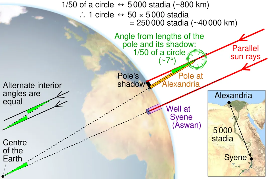
What angular measurement did Eratosthenes use to relate the distance between Syene and Alexandria to the Earth's total circumference?What geometric term describes the Earth's shape, which bulges slightly at the equator due to its rotation?What does a geodetic datum mathematically define for surface measurements?By what unit was the distance between Syene and Alexandria measured by Eratosthenes, resulting in his circumference calculation?What term refers to the actual, irregular physical surface that corresponds to the mean sea level?Satellite Laser Ranging (SLR) achieves high accuracy by precisely measuring what property of a laser pulse traveling to an orbiting satellite and back?GPS receivers determine their three-dimensional coordinates relative to which specific reference frame mentioned in the text?Which highly precise geodetic method ties the terrestrial coordinate system directly to a fixed, extra-terrestrial reference frame by observing distant quasars?Which process is used to determine the Earth's age, as opposed to its current size and shape determined by geodesy?What is the approximate difference in kilometers between the Earth's equatorial diameter and its polar diameter?Eratosthenes' initial effort established that measuring large-scale terrestrial dimensions relies on what fundamental combination?