What did NASA say about the ocean?
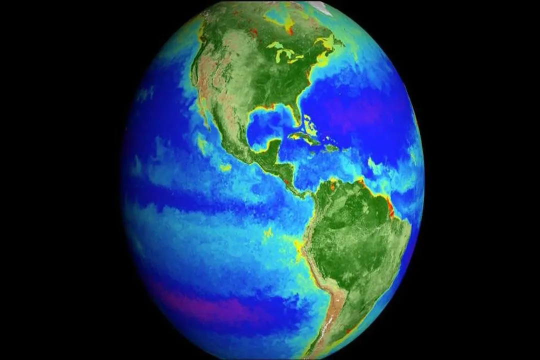
Looking at Earth from space, it becomes immediately clear that we inhabit a water planet; roughly 70 percent of the surface is covered by the ocean. [3] NASA’s involvement with the ocean is not about planting flags or sampling sediments from the deep—that ground-level work is primarily the domain of agencies like NOAA—but rather about holding the largest piece of our global system under constant, wide-ranging observation. [6] What NASA says about the ocean centers almost entirely on its physics, its immense role in regulating global climate, and the development of advanced tools to measure its changing state from orbit. [1][2]
# Climate Regulator
The sheer scale of the ocean’s influence on Earth's climate system cannot be overstated. NASA data confirms that the ocean acts as a massive thermal buffer, absorbing vast quantities of heat from the atmosphere. [2] This absorption is critical; without the oceans moderating this energy transfer, the warming trend on land would be far more severe. [2]
Beyond heat, the ocean is also a major sink for atmospheric carbon dioxide (). [2] By pulling this greenhouse gas out of the air, the ocean slows the rate of climate change, though this absorption comes at a cost, leading to ocean acidification. [2] Furthermore, NASA monitors how the ocean interacts with the water cycle, tracking precipitation and evaporation over the vast, inaccessible stretches of open water where few direct measurements can be taken consistently. [1] The health of these ocean systems directly dictates much of our planet’s weather patterns and long-term stability. [2]
# Satellite View

NASA’s expertise in observing the ocean stems from its pioneering use of remote sensing technology. Unlike ship-based measurements, which are sporadic and localized, satellites provide near-global, consistent coverage, allowing scientists to track processes across entire ocean basins. [1] This ability to gather repetitive, uniform data over decades is what allows researchers to establish clear trends rather than just snapshots of conditions. For example, if one were to only rely on measurements taken by research vessels, we might observe high sea levels in the Gulf of Mexico one year and low levels in the Pacific the next, leading to confusion; satellite altimeters, however, provide a consistent baseline for determining system-wide change. [1]
Key physical oceanography measurements that NASA focuses on include:
- Sea Surface Height (Altimetry): Missions track changes in sea level. [1]
- Sea Surface Temperature: Essential for understanding heat distribution and ocean circulation patterns. [1]
- Salinity: Measured to track the movement of water masses, as fresh water from melting ice or heavy rain affects density and drives currents. [1]
- Ocean Circulation: Understanding how currents distribute heat, carbon, and nutrients around the globe. [1]
Specific satellite missions contribute to this ongoing data record. Missions like the GRACE and GRACE-FO satellites monitor changes in Earth’s gravity field, which helps scientists calculate changes in water storage, including ice mass loss that contributes to sea level rise. [1] The Jason series of satellites, in partnership with other agencies, continuously maps the precise height of the ocean surface. [4] NASA’s Earth Observing System Data and Information System (EOSDIS) organizes and distributes this wealth of information, enabling scientists to look at specific variables like sea ice cover, coastal ocean dynamics, and biogeochemistry across the water column. [5]
# Rising Waters
One of the most visible and consequential changes NASA tracks is the rise in global sea level. [2][4] The agency’s observations show that the average global sea level is rising at an accelerating rate, currently measured around $3.4$ millimeters per year, based on altimetry data. [4]
NASA emphasizes that this rise isn't due to one single cause but two primary, interrelated factors:
- Thermal Expansion: As the ocean absorbs excess heat, the water physically expands because warmer water takes up more space than cooler water. [2][4]
- Melting Ice: Water flows into the ocean from melting glaciers and ice sheets on land, such as those in Greenland and Antarctica. [2][4]
The long-term commitment to measuring these rates is invaluable. When analyzing the inputs, it becomes clear that understanding the exact contribution of Greenland versus Antarctic ice melt, and tracking how the ocean’s thermal structure changes with depth, requires the continuous, high-precision measurements that only orbital assets can reliably deliver over geological timescales. [1] This continuity is an often-overlooked benefit; understanding climate trends requires observing the same variable with the same instrument specifications for decades, something that NASA’s sustained Earth science program aims to provide. [1]
# Ocean Variables
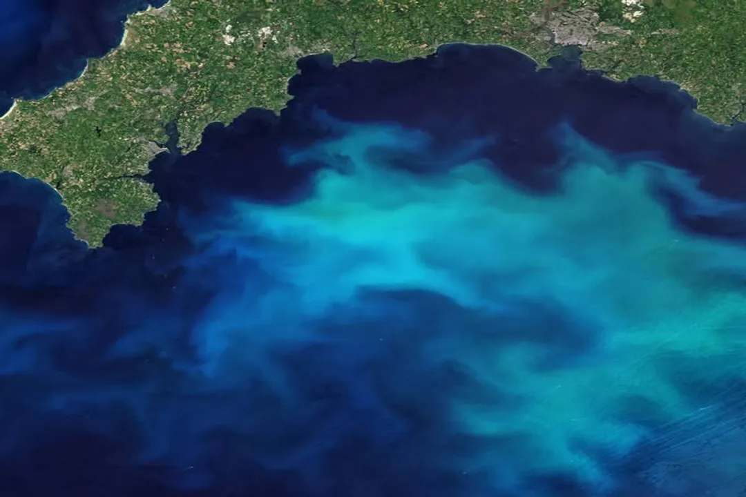
NASA's view of the ocean is intentionally broad, categorizing its interest across several major themes that span physical science and ecological implications. [5] While the physics of temperature and current dominate global climate discussions, the agency also pays attention to processes affecting coastal regions and the marine environment's chemistry. [5]
Studies look into:
- Physical Oceanography (currents, waves, temperature). [5]
- Biogeochemistry (the cycling of carbon and nutrients). [5]
- Sea Ice concentration and extent. [5]
- Coastal Ocean processes, which are vital for understanding erosion and human interaction with the sea. [5]
It is interesting to note how these variables interconnect in the data sets. For example, tracking the influx of freshwater from melting Arctic ice (sea ice/physical oceanography) affects the salinity measurements, which in turn influences models predicting changes in deep-water formation rates (physical oceanography/climate regulation). [1][2]
# Research Integrity
In connection with the public discourse surrounding its scientific findings, NASA has had to address claims related to its observational scope. There have been circulating online rumors suggesting that NASA abruptly ceased or stopped deep-sea research. [9] However, official statements and fact-checking efforts confirm that this assertion is inaccurate. [8] NASA’s primary mandate regarding the ocean is Earth observation from space—measuring surface height, temperature, and gravity effects—which is an active, ongoing discipline central to its Earth science division. [1][8] The agency's focus is centered on global, remote sensing capabilities, not the direct, ship-based exploration of the abyssal depths, a distinction often lost in broad online discussions. [8] Maintaining clarity about which part of the ocean environment an agency is tasked with monitoring—the surface interface with the atmosphere, as seen from orbit—is key to trusting the data being released. [1][5]
#Videos
NASA Reveals New Discoveries on Oceans Beyond Earth During ...
Related Questions
#Citations
Oceanography - NASA Science
and as our planet is changing, so is the ocean. NASA has several ...
NASA's Earth Minute: Sea Level Rise
Ocean | NASA Earthdata
How much of the ocean has been explored?
NASA Reveals New Discoveries on Oceans Beyond Earth During ...
Fact Check: NASA did not abruptly stop deep-sea research - Reuters
There's a Reason NASA Stopped Exploring the Deep Sea : r/nosleep